


Return to the Peel Journal - Day 6 RCGS Expedition 2018
- Apr 14, 2019
- 4 min read
July 22, 2018 Day 6. Temp about 14c and partly cloudy.
Video of campsite on Wind at Little Wind River.
We're camped at convergence of the Wind and Little Wind Rivers. We’re surrounded by mostly spruce-covered hills with beautiful distant mountains to the west, up the Little Wind. Bare and jagged peaks like those we left behind yesterday.
Sitting here on the river’s edge I have one Tragically Hip lyric running through my head: “I have my hands in the river, my feet back up on the bank. I look up to the Lord above and say, Hey man, thanks.”
With the two rivers meeting here, the speed of the water is impressive. I’d be hard pressed to run with it for any great distance. Guessing it’s 15 km/h or more.
Yesterday we left the mountains and dropped steadily, some 200 m or more of altitude by the end of the day. At one point I swear my ears my popped. We entered a wide, forested plain and then into rolling hills.
Dall Sheep on cliff face on lower Wind River.
Where the hills met the river with cliffs Graham spotted our first Dall Sheep. A type of mountain goat, white against the gray rocks, looking down us from an impossible perch 100 feet above. Their ability to climb on steep cliff faces is uncanny. Terry correctly pointed out that there are very few predators that could follow this Dall Sheep as he picked his way confidently up the steep cliff. We also saw our second woodland caribou, this one jogged along beside us as we entered a set of rapids, before cutting into the spruce forest.
Swift waters of the lower Wind River.
This was the fastest day of travel by far. The river was a series of class 1 and 2 rapids that could be handled without scouting from shore. We all agreed it was like a day long amusement ride: calm of fast water, followed by the thrill of rapids and repeat around the next bend.
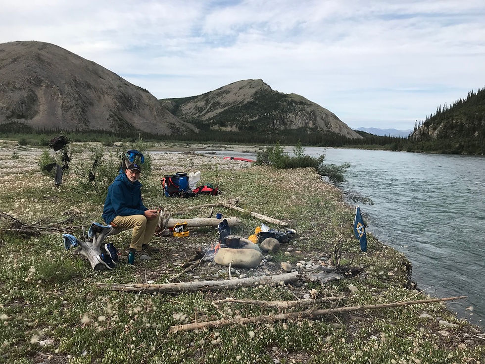
Terry at campsite at the Little Wind River.
When we arrived at our campsite last night, a long gravel and meadow island, we walked up to a ready-made fire pit and Terry said: “You can tell Dene (First Nations) people made this. It’s built for comfort.” True enough. Around the fire pit are logs raised on stumps, perfect seats to sit and stare into the fire.
Terry’s comment is a good reminder that this was and still remains the traditional lands of the Gwich’in people. The Wind is their winter hunting grounds. In the spring, they’d load up provisions into moose-hide boats and ride the high waters from the snow melt down to the Peel where they’d spend the summer. The last of the moose hide flotillas came down
in 1929 but the Gwich’in continue to live off of and manage this land to this day.
And while Charles Camsell was the first to officially map this country on paper in 1905, it was well mapped in the oral traditions of the Gwich’in for centuries before. Terry is part Gwich’in and we’re looking forward to meeting his relatives in Fort McPherson, the only size-able community in the Peel Watershed. Being downstream from much of the watershed, Fort McPherson would have potentially suffered the most from any consequences if the Yukon government had opened much of the Peel to mining exploration, as they’d proposed to do.
Terry is also the grandson of Sam Carter, a member of the famous “Lost Patrol,” a Royal North West Mounted Police Patrol that was on a winter run from Ft McPherson to Dawson. Their route took them up the Little Wind River, right where we are now. Up that valley, they lost their way, missing the pass they needed to take to Dawson. With temperatures at -60 C and still not finding their way, they doubled back to Ft McPherson.
When food ran out, they ate their sled dogs. All four men eventually died, from starvation and the cold, with one killing himself. It is still the single worst loss of life for the Mounties in one incident. We’ll visit the monuments to the dead men along the Peel River.

David and Terry paddling to Hungry Creek.
But today we head to Hungry Creek to pan for gold. This was the main reason for Charles Camsell being sent on his 1905 expedition. This is an excerpt from Camsell’s memoir, “Son of the North”: “A story reached Ottawa...that there had been a mysterious stampede out of Dawson into the country to the east where a new placer gold field was said to have been found…I was instructed to investigate…Placer gold was reported to have been found on a tributary of the Wind River known as Hungry Creek.”
Turns out that that stampede was most likely just two guys. More on their story when we reach Hungry Creek.
Camsell’s 1905 Survey note about our route today: “Below the Little Wind River, the Wind River widens considerably. It is filled with gravel bars.…The valley is shallow…The only stream of any consequence entering below the Little Wind is Hungry Creek…25 miles above the Peel.”

Camsell's 1905 showing this section of the Expedition.
I want to note that both Camsell’s map and his Survey report, 113 years old, have been our most useful and accurate guides to long stretches of this river. We’ve taken to reading the relevant parts of his report out loud in the evening, plotting out the day ahead.

Comments